Clarks Hill/Strom Thurmond
Clarks Hill/Strom Thurmond
Couldn't load pickup availability
Clarks Hill/Strom Thurmond Lake in Unknown County, GA, SC
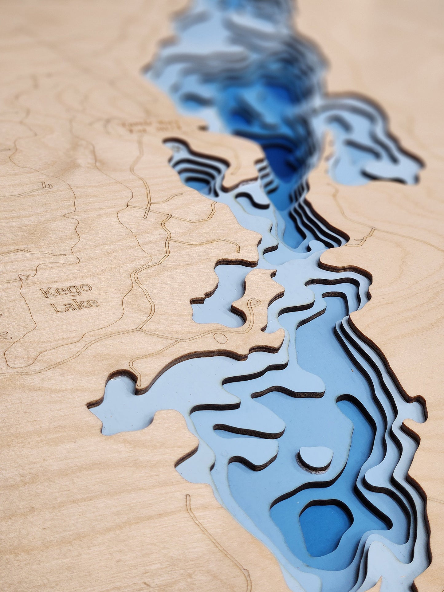
This lake has 8 Layers or 15 Layers for HD Version
Clarks Hill Lake, also federally known as J. Strom Thurmond Lake, is a vast reservoir located on the border of Georgia and South Carolina, with its Georgia portions spanning Columbia, Elbert, Lincoln, and McDuffie Counties. Covering approximately 71,100 acres and boasting an extensive 1,200 miles of shoreline, it is one of the Southeast's premier recreational destinations. The lake is renowned for its excellent fishing, with popular species including largemouth bass, striped bass, hybrid bass, crappie, and catfish. Numerous boat ramps and marinas provide access for anglers and boaters.
Recreational opportunities abound at Clarks Hill Lake. The area offers excellent boating, waterskiing, swimming, hiking, and picnicking. Several state parks and recreation areas along the shoreline provide campgrounds, beaches, and trails. The lake is also a popular spot for birdwatching and offers opportunities to explore its many islands and coves. With its significant size and diverse amenities, Clarks Hill Lake attracts visitors seeking outdoor adventures and relaxation in a beautiful setting.
Dimensions:
Small: 8"x12"
Medium: 12"x18"
Large: 16"x24"
Extra Large: 20"x30"
XX Large: 24"x36"
Gigantic 30"x45"
HD Extra Large: 20"x30" - 15 Layers
HD XX Large: 24"x36" - 15 Layers
HD Gigantic 30"x45" - 15 Layers
The difference between standard and HD maps is the number of layers. Standard maps have 1 land layer and 7 water layers. The HD lake maps have 1 land layer and 14 water layers. So twice the detail. The HD Maps are limited to Extra Large, XX Large, and Gigantic sizes only. On the smaller sizes the depth change of the wood is too extreme and you end up losing detail.
Share