Higgins (Roscommon)
Higgins (Roscommon)
Couldn't load pickup availability
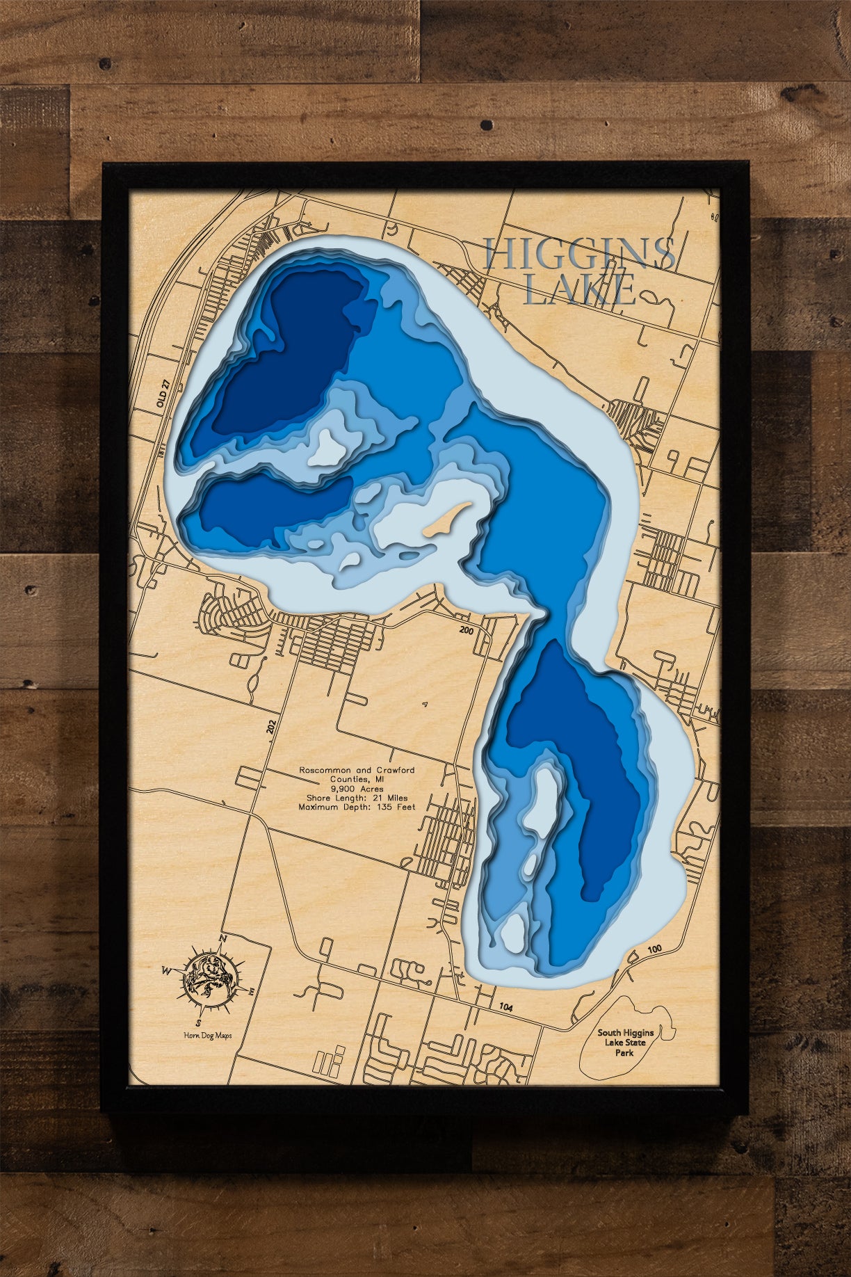
3d Lake Map of Higgins Lake in Roscommon County, MI
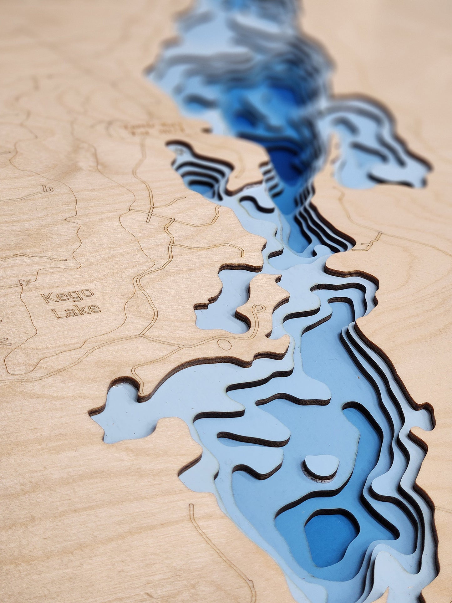
This map has 8 layers
Higgins Lake, a majestic 9,900-acre lake located primarily in Roscommon and Crawford Counties, Michigan, is celebrated as one of the state's largest and most pristine inland lakes. Renowned for its exceptional clarity and deep, spring-fed waters, this Michigan gem plunges to an impressive maximum depth of 135 feet. With a sprawling shoreline stretching 21 miles, Higgins Lake offers expansive natural beauty and abundant opportunities for both tranquil retreats and active recreation.
As a premier destination in Michigan, Higgins Lake attracts a wide array of outdoor enthusiasts. Its deep, cold waters provide an ideal habitat for species such as Lake Trout and Perch, making it a favorite among anglers. Boating, sailing, swimming, and various watersports are incredibly popular activities across its vast surface. The lake is surrounded by state parks, including South Higgins Lake State Park and North Higgins Lake State Park, which provide excellent public access, camping facilities, and hiking trails, further cementing Higgins Lake's status as a top-tier recreational haven in Northern Michigan.
Dimensions:
Small: 8"x12"
Medium: 12"x18"
Large: 16"x24"
Extra Large: 20"x30"
XX Large: 24"x36"
Gigantic 30"x45"
HD Extra Large: 20"x30" - 15 Layers
HD XX Large: 24"x36" - 15 Layers
HD Gigantic 30"x45" - 15 Layers
The difference between standard and HD maps is the number of layers. Standard maps have 1 land layer and 7 water layers. " The HD lake maps have 1 land layer and 14 water layers. So twice the detail. The HD Maps are limited to Extra Large, " XX Large, and Gigantic sizes only. On the smaller sizes the depth change of the wood is too extreme and you end up losing detail."
Share