

Indian Lake in Logan County, Ohio
Indian Lake in Logan County, Ohio
Couldn't load pickup availability
Indian Lake in Logan County, Ohio
This map has 8 layers
Indian Lake is a historic 5,104-acre reservoir in Logan County, western Ohio, making it the second-largest inland lake in the state. Originally a group of small lakes and wetlands covering just 640 acres, the area was transformed in the 1850s into the "Lewistown Reservoir" to supply water for the Sidney Feeder of the Miami and Erie Canal. Named by early settlers for the Native American tribes who inhabited the region, the lake is fed by the north and south forks of the Upper Great Miami River, Cherokee Mans Run, Blackhawk Creek, and Van Horn Creek, with its outlet at the historic spillway marking the beginning of the Great Miami River. With a maximum depth of 20 feet and an average depth of 6-8 feet, Indian Lake features approximately 30 miles of scenic shoreline, 69 tree-covered islands including the famous "Indian Isles" chain that arcs through the center of the lake, expansive wildlife areas accessible through a network of channels, and numerous inlets and bays that create a diverse and picturesque waterscape
Indian Lake has evolved into one of Ohio's premier recreational destinations, nationally recognized for its exceptional Saugeye fishing along with excellent populations of Largemouth Bass, White and Black Crappie, Bluegill, Channel Catfish, White Bass, Yellow Perch, and Bullheads. The lake hosts numerous major fishing tournaments throughout the year and has earned acclaim as a top fishing destination. With no horsepower restrictions, the lake is ideal for all types of boating including water skiing, tubing, jet skiing, kayaking, and sailing. Located approximately 20 miles southeast of Lima and within an hour's drive of Columbus, Dayton, and Lima, the lake area encompasses the towns of Russells Point, Lakeview, and Huntsville, offering visitors easy access to shops, restaurants, marinas, and lodging. Managed as part of the Ohio State Park system, Indian Lake features extensive facilities including multiple boat ramps at Moundwood and Lakeview Harbor, full-service marinas, two public swimming beaches (Oldfield Beach and Fox Island Beach), campgrounds, a 2.5-mile paved lakefront biking and walking trail, eight picnic areas with volleyball and basketball courts, and the Cherokee Trail for hiking through wooded wetlands featuring one of Ohio's oldest Swamp Cottonwood Trees
Dimensions:
Small: 8"x12"
Medium: 12"x18"
Large: 16"x24"
Extra Large: 20"x30"
XX Large: 24"x36"
Gigantic 30"x45"
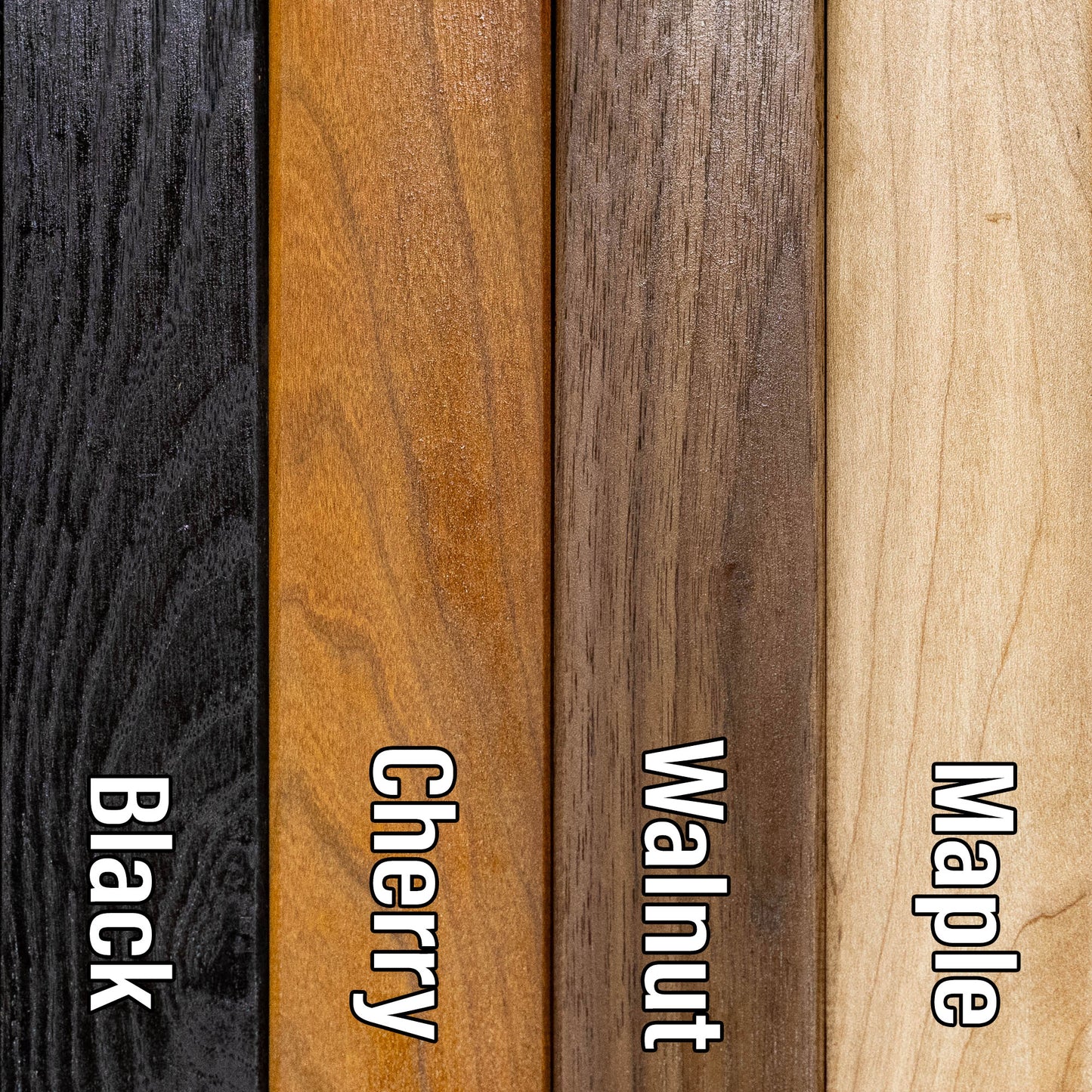
Cribbage Boards - 10"x14" - Your choice of Maple or Cherry wood, 2 or 3 runs, and your choice of peg colors.
Share




About our Maps
Every map is designed and built in Minnesota. Nothing is outsourced and nothing is imported.
- Designed in-house. All art files are created by me, not purchased or reused
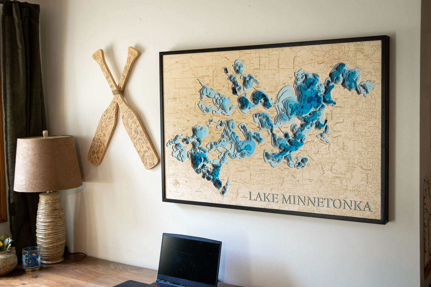
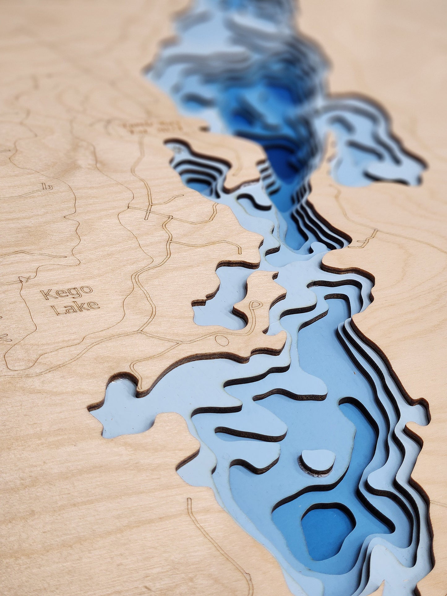
- True layered 3D construction. Not engraved or printed
- More layers, more detail. Most competitors use 3 to 7 layers. These use 8 or 15 layers
- Original blue depth gradient. Light to dark blue shows water depth clearly
- Handmade hardwood frames. Built from locally sourced rough sawn lumber, not pre-made frames
These are built to be the most accurate and most detailed 3D lake maps available.
Horn Dog Maps vs Others
True layered 3D construction
Horn Dog Maps: Yes
Other Companies: No
Etsy Sellers: Sometimes
Designed in-house (no purchased files)
Horn Dog Maps: Yes
Other Companies: Sometimes
Etsy Sellers: No
Made in Minnesota
Horn Dog Maps: Yes
Other Companies: No
Etsy Sellers: No
Number of layers
Horn Dog Maps: 8 or 15
Other Companies: 3 to 7
Etsy Sellers: 3 to 7
Blue depth gradient water
Horn Dog Maps: Yes
Other Companies: No
Etsy Sellers: No
Handmade hardwood frame included
Horn Dog Maps: Yes
Other Companies: No
Etsy Sellers: No
Uses multiple depth data sources
Horn Dog Maps: Yes
Other Companies: Sometimes
Etsy Sellers: No
Custom lakes without delays
Horn Dog Maps: Yes
Other Companies: No
Etsy Sellers: No
Connection to the lakes
Horn Dog Maps: Yes
Other Companies: No
Etsy Sellers: No
Frequently Asked Questions
Are these actually 3D or just engraved?
These are true 3D layered maps.
- Made from 1/8 inch Baltic birch
- Standard maps have 8 layers. 1 land layer and 7 water layers
- HD maps have 15 layers. 1 land layer and 14 water layers
Each water layer uses a light to dark blue gradient so depth changes are easy to see.
Where are these made?
Everything is made in my shop in Minnesota.
- Design
- Cutting
- Painting
- Assembly
- Frame building
The frames start as locally sourced rough sawn hardwood and are built from scratch.
Do you use real depth data?
Yes, as an angler and map nerd, accuracy matters to me. I use multiple data sources, up to six, to find the most accurate lake contours available.
I would not hang an inaccurate map in my house and I will not send one to yours.
Why buy from Horn Dog Maps instead of Etsy or marketplace sellers?
Most marketplace sellers:
- Buy pre-made cut files, often from overseas
- Have no connection to the lakes
- Cannot verify accuracy
- Have long delays if a file is not available
This leads to lower accuracy and longer lead times, often 6 to 8 weeks.
Because I design everything myself:
- I can create a new lake mockup in about 30 minutes
- You get a more accurate map, faster
What is your lead time?
Most orders ship in 1.5 to 2 weeks depending on the time of year.
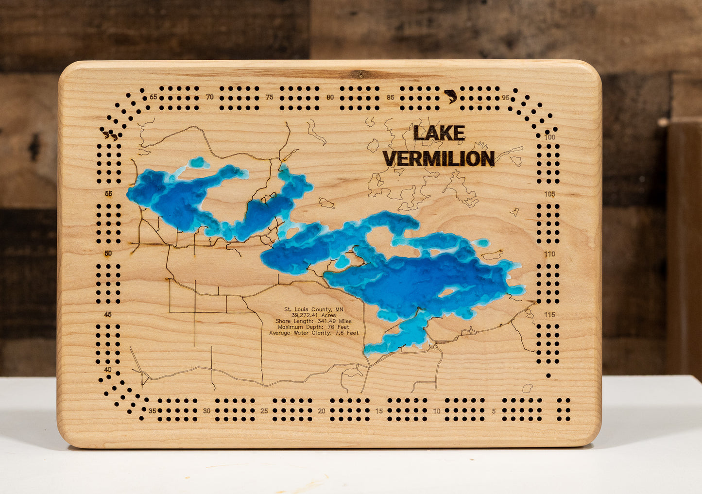
Tell me about the Cribbage Boards
These are different from the layered maps and are not something you will find elsewhere.
- Made from a solid piece of Maple or Cherry
- The lake is engraved as if drained
- Then filled with blue tinted epoxy that is still transparent
You can see:
- Channels
- Humps
- Points
- Structure
Additional features:
- 2 or 3 track options
- Choice of peg colors
- Hidden peg storage with a magnetic dovetail slider
- Rubber feet so it does not slide on the table
It is a functional game board and a detailed lake model in one.