Leelanau (Leelanau)
Leelanau (Leelanau)
Couldn't load pickup availability
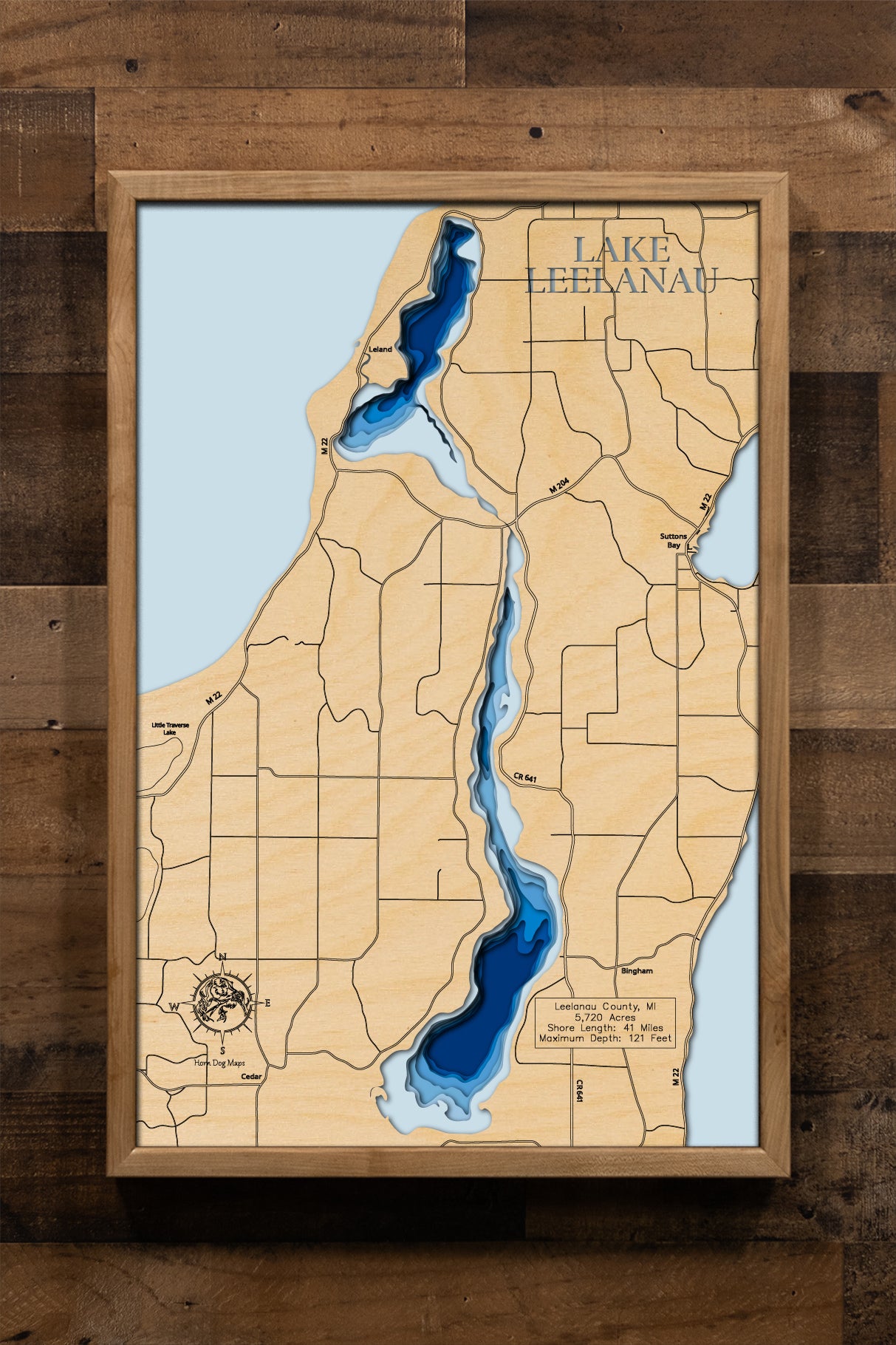
Lake Leelanau in Leelanau County, MI
This map has 8 layers
Lake Leelanau, a cherished natural lake located in Leelanau County, Michigan, is a significant feature of the state's iconic northern Lower Peninsula. This expansive body of water is effectively two lakes, North Lake Leelanau and South Lake Leelanau, connected by a narrow channel at the village of Lake Leelanau. Combined, the lake spans 5,720 acres, with the deeper South Lake Leelanau reaching a maximum depth of 121 feet, while North Lake Leelanau extends to 62 feet. The combined shoreline stretches approximately 41 miles, offering extensive access to its clear, inviting waters.
As a premier recreational hub in Leelanau County, Lake Leelanau is a magnet for visitors and residents alike, drawn by its pristine conditions and diverse activities. Boating, swimming, and watersports are highly popular across both sections of the lake. Anglers find abundant opportunities targeting Walleye, Northern Pike, Largemouth Bass, Smallmouth Bass, and various panfish. The lake's detailed bathymetry, often available with 10-foot contour intervals, aids in navigating its depths and locating fish. The surrounding Leelanau Peninsula is renowned for its vineyards, charming small towns, and stunning natural beauty, making Lake Leelanau a central jewel in Michigan's famous "Mitten."
or living space.
Dimensions:
Small: 8"x12"
Medium: 12"x18"
Large: 16"x24"
Extra Large: 20"x30"
XX Large: 24"x36"
Gigantic 30"x45"
HD Extra Large: 20"x30" - 15 Layers
HD XX Large: 24"x36" - 15 Layers
HD Gigantic 30"x45" - 15 Layers
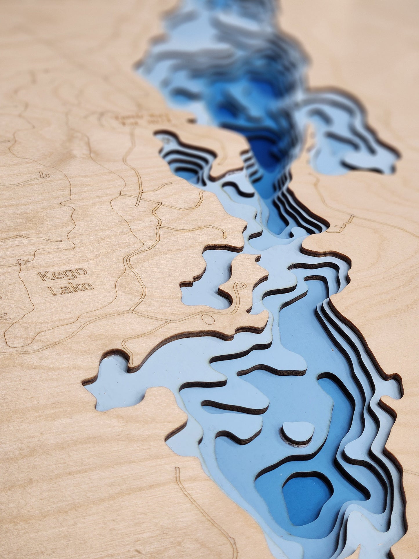
The difference between standard and HD maps is the number of layers. Standard maps have 1 land layer and 7 water layers. " The HD lake maps have 1 land layer and 14 water layers. So twice the detail. The HD Maps are limited to Extra Large, " XX Large, and Gigantic sizes only. On the smaller sizes the depth change of the wood is too extreme and you end up losing detail."
Share