Norman (Catawba, Iredell, Lincoln, Mecklenburg)
Norman (Catawba, Iredell, Lincoln, Mecklenburg)
Couldn't load pickup availability
Lake Norman in Catawba, Iredell, Lincoln, Mecklenburg Counties, North Carolina
This map has 8 layers
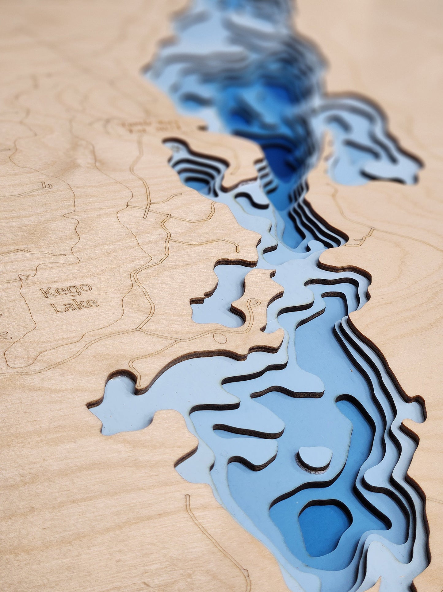
Lake Norman, a vast 32,500-acre reservoir, stands as the largest man-made body of water in North Carolina, encompassing portions of Iredell, Lincoln, Catawba, and Mecklenburg Counties. Created by Duke Power (now Duke Energy) for hydroelectric power generation, this expansive lake boasts an impressive 520 miles of intricate shoreline, often dubbed "the inland sea" of North Carolina. Reaching a maximum depth of 110 feet, Lake Norman plays a critical role in the region's energy supply and serves as a premier recreational hub.
As a highly sought-after destination, Lake Norman is central to the vibrant communities surrounding it, offering unparalleled opportunities for water-based recreation in North Carolina. Anglers are drawn to its productive waters for abundant populations of Largemouth Bass, Striped Bass, Catfish, and Crappie. The lake's immense surface is ideal for all forms of boating, waterskiing, wakeboarding, and sailing, attracting enthusiasts from across the Carolinas. Its numerous coves, islands, and public access points, coupled with lakeside dining and entertainment, cement Lake Norman's status as a dynamic and essential part of the Charlotte metropolitan area's lifestyle and tourism economy.
Dimensions:
Small: 8"x12"
Medium: 12"x18"
Large: 16"x24"
Extra Large: 20"x30"
XX Large: 24"x36"
Gigantic 30"x45"
HD Extra Large: 20"x30" - 15 Layers
HD XX Large: 24"x36" - 15 Layers
HD Gigantic 30"x45" - 15 Layers
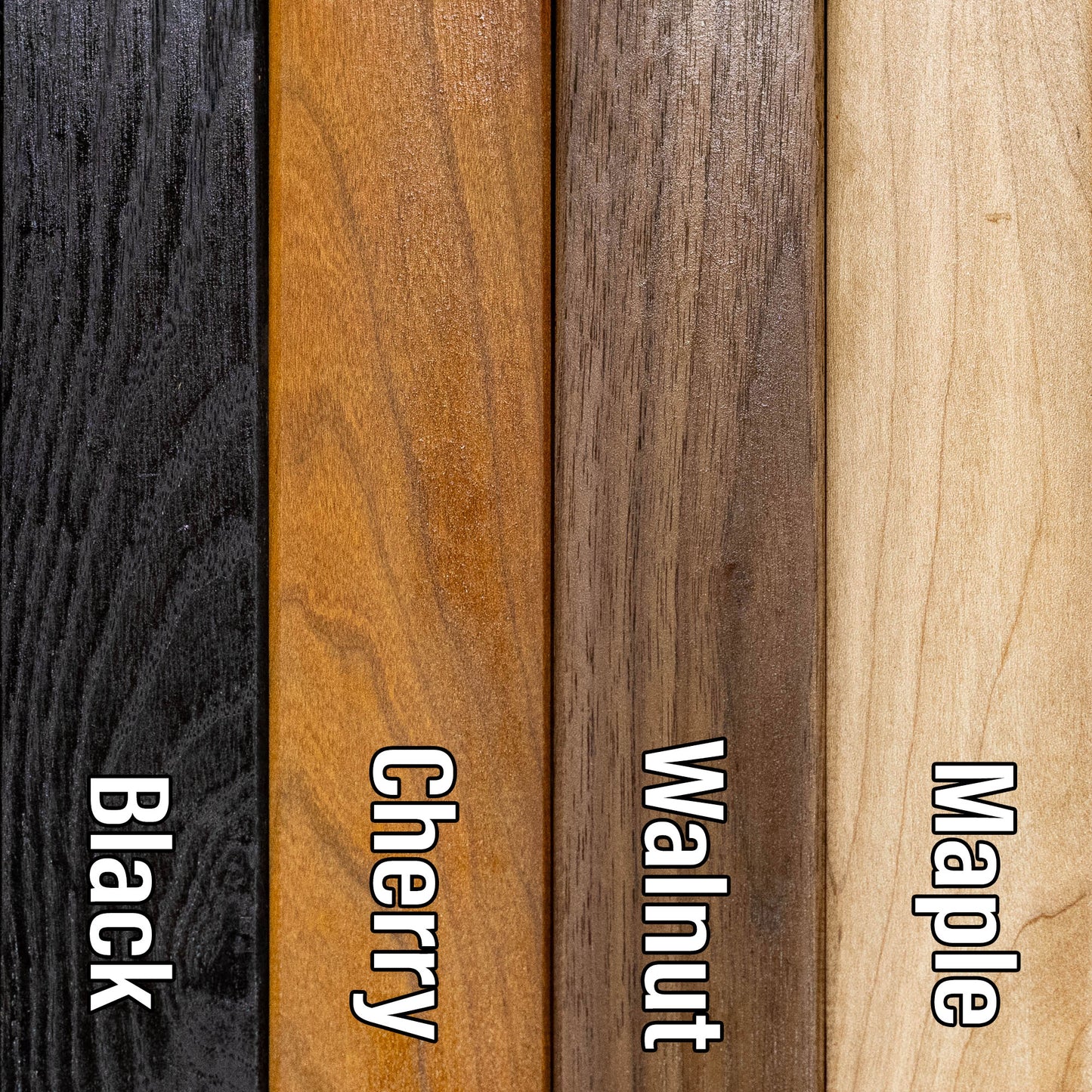
The difference between standard and HD maps is the number of layers. Standard maps have 1 land layer and 7 water layers. " The HD lake maps have 1 land layer and 14 water layers. So twice the detail. The HD Maps are limited to Extra Large, " XX Large, and Gigantic sizes only. On the smaller sizes the depth change of the wood is too extreme and you end up losing detail."
Share