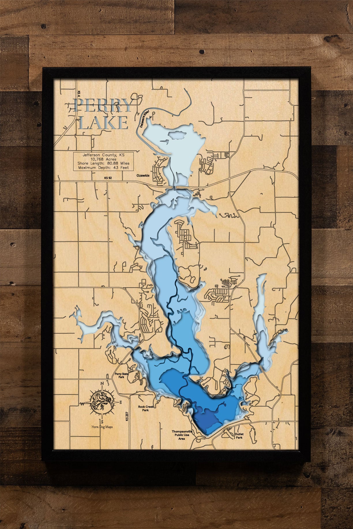
Perry Lake in Jefferson County, KS
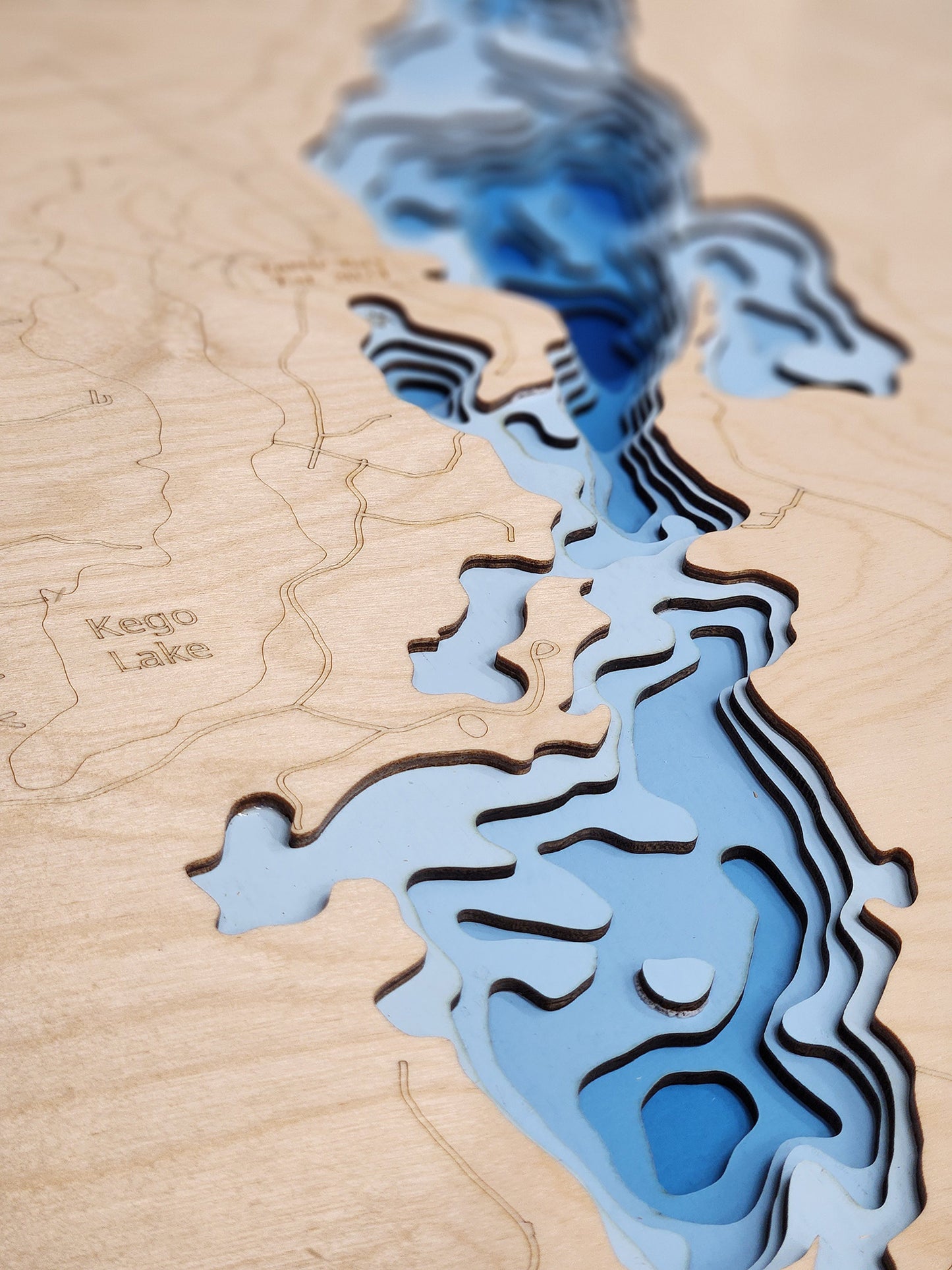
This map has 8 layers
Perry Lake, a U.S. Army Corps of Engineers reservoir located in Jefferson County, Kansas, covers approximately 11,150 acres and has an extensive shoreline of 160 miles. With a maximum depth of 43 feet, the lake serves multiple purposes, including flood control, water supply, and recreation. It is a popular destination for a variety of outdoor activities such as boating, fishing, swimming, camping, and hiking.
Anglers are drawn to Perry Lake for its diverse fish populations, including white crappie, channel catfish, white bass, and sauger. Largemouth and smallmouth bass, as well as blue catfish, are also present. The lake and surrounding Perry State Park offer numerous recreational facilities, including boat ramps, campgrounds, hiking and biking trails, and equestrian trails. The 30-mile Perry Lake National Recreational Hiking Trail is particularly renowned. Additionally, the Longview Disc Golf Course provides another outdoor activity option for visitors.
Dimensions:
Small: 8"x12"
Medium: 12"x18"
Large: 16"x24"
Extra Large: 20"x30"
XX Large: 24"x36"
Gigantic 30"x45"
HD Extra Large: 20"x30" - 15 Layers
HD XX Large: 24"x36" - 15 Layers
HD Gigantic 30"x45" - 15 Layers
The difference between standard and HD maps is the number of layers. Standard maps have 1 land layer and 7 water layers. " The HD lake maps have 1 land layer and 14 water layers. So twice the detail. The HD Maps are limited to Extra Large, " XX Large, and Gigantic sizes only. On the smaller sizes the depth change of the wood is too extreme and you end up losing detail."