Sinclair
Sinclair
Couldn't load pickup availability
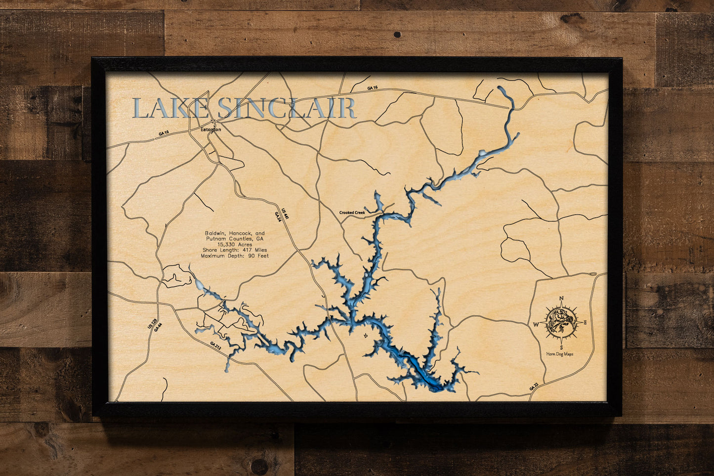
Lake Sinclair in Baldwin, Hancock, and Putnam Counties, Georgia
This lake has 8 Layers or 15 Layers for HD Version
Lake Sinclair, a 15,330-acre reservoir with 417 miles of shoreline, is located in central Georgia, stretching through Baldwin, Hancock, and Putnam Counties. Created in 1953 by damming the Oconee River, this lake is operated by Georgia Power and serves as a popular recreational destination. Anglers are drawn to Lake Sinclair for its excellent fishing, with species including Largemouth Bass, Hybrid Bass, Striped Bass, Catfish, Crappie, and Bream. The lake hosts numerous fishing tournaments throughout the year.
Recreational opportunities on Lake Sinclair are diverse, encompassing boating, swimming, and various watersports. There are public boat ramps and marinas providing access to the water. The surrounding area offers scenic beauty, with wooded hills and several islands dotting the lake. Oconee Springs Park and Rocky Creek Park provide day-use facilities such as picnic tables, grills, and boat ramps, with camping and cabin rentals available at Oconee Springs Park. Lake Sinclair is a significant recreational resource in central Georgia, attracting both residents and visitors.
Dimensions:
Small: 8"x12"
Medium: 12"x18"
Large: 16"x24"
Extra Large: 20"x30"
XX Large: 24"x36"
Gigantic 30"x45"
HD Extra Large: 20"x30" - 15 Layers
HD XX Large: 24"x36" - 15 Layers
HD Gigantic 30"x45" - 15 Layers
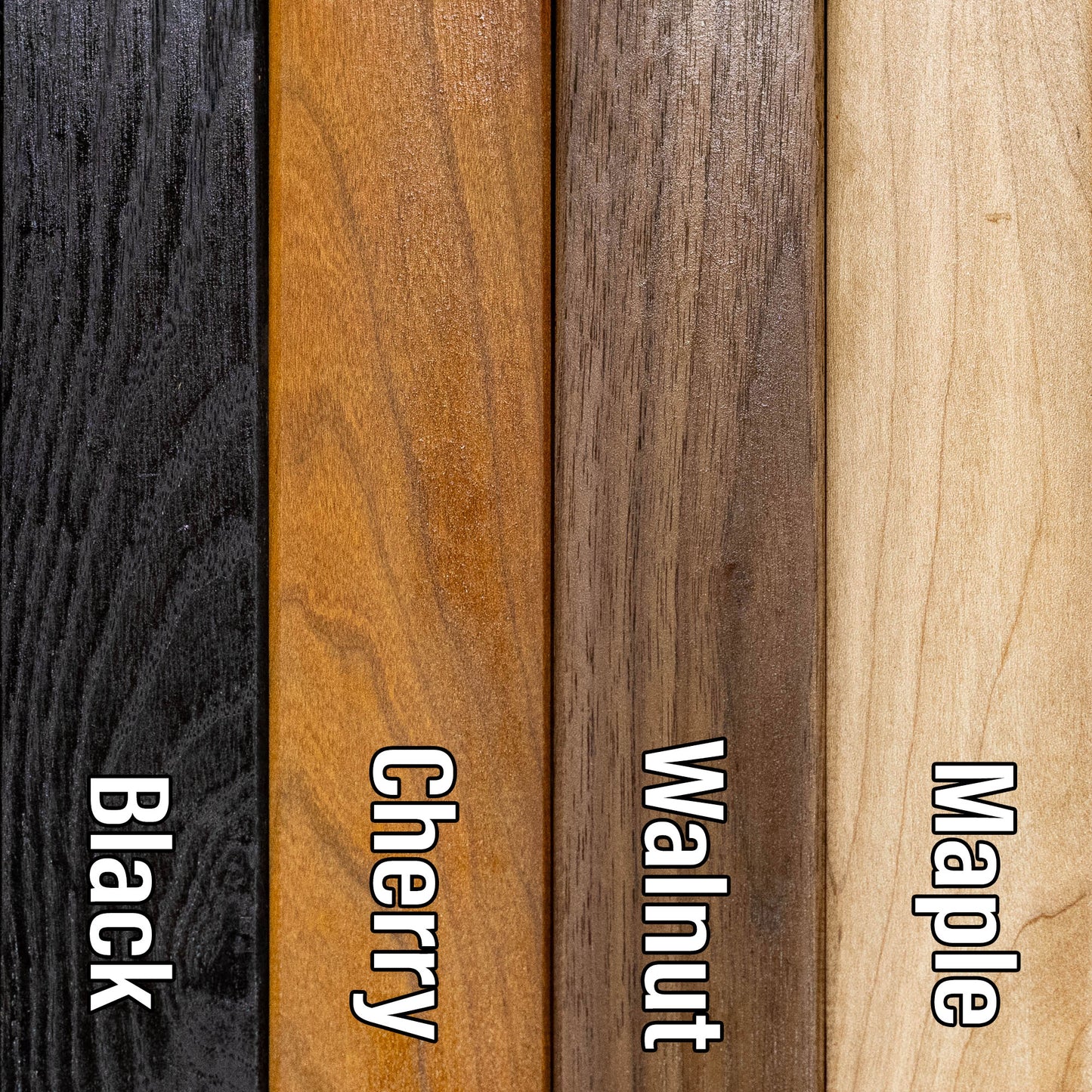
The difference between standard and HD maps is the number of layers. Standard maps have 1 land layer and 7 water layers. The HD lake maps have 1 land layer and 14 water layers. So twice the detail. The HD Maps are limited to Extra Large, XX Large, and Gigantic sizes only. On the smaller sizes the depth change of the wood is too extreme and you end up losing detail.
Share