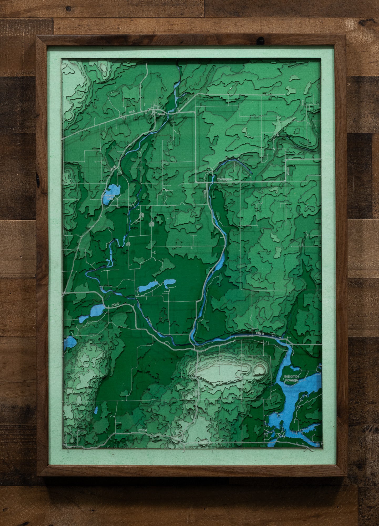
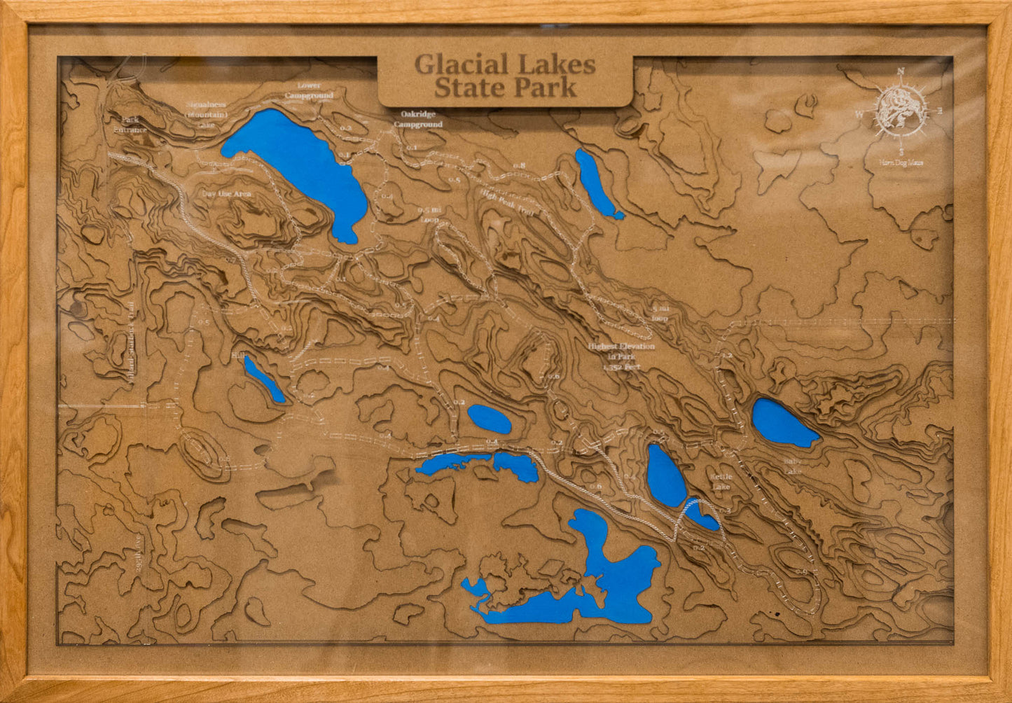
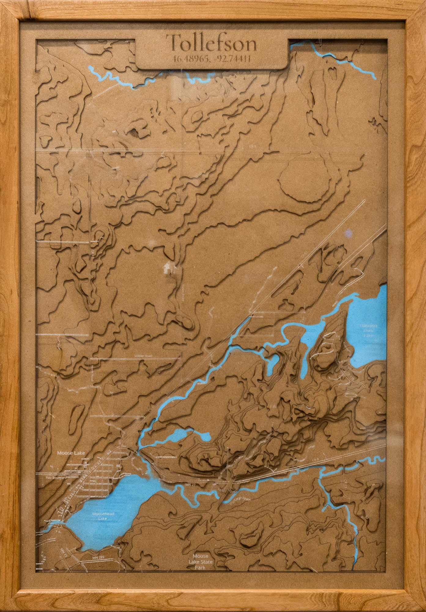
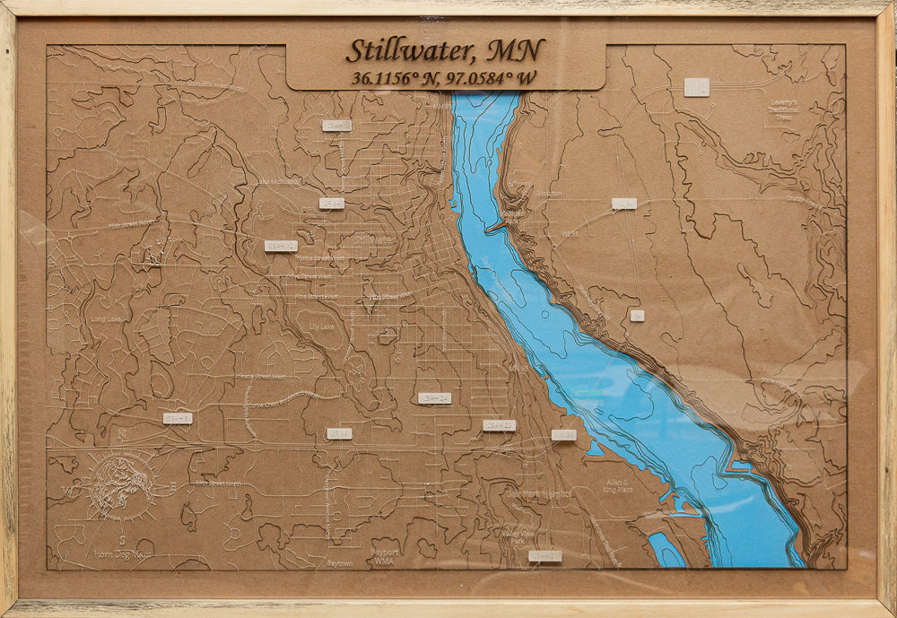
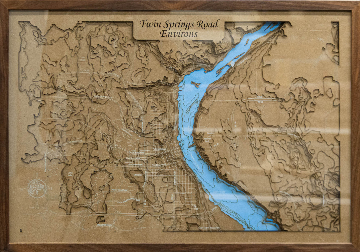
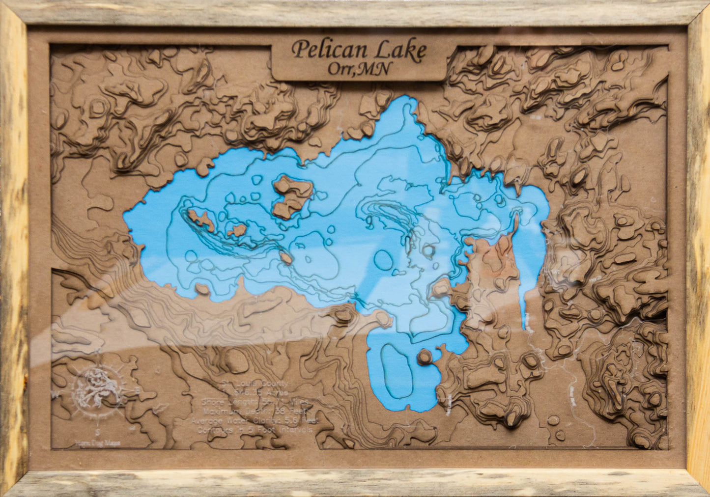
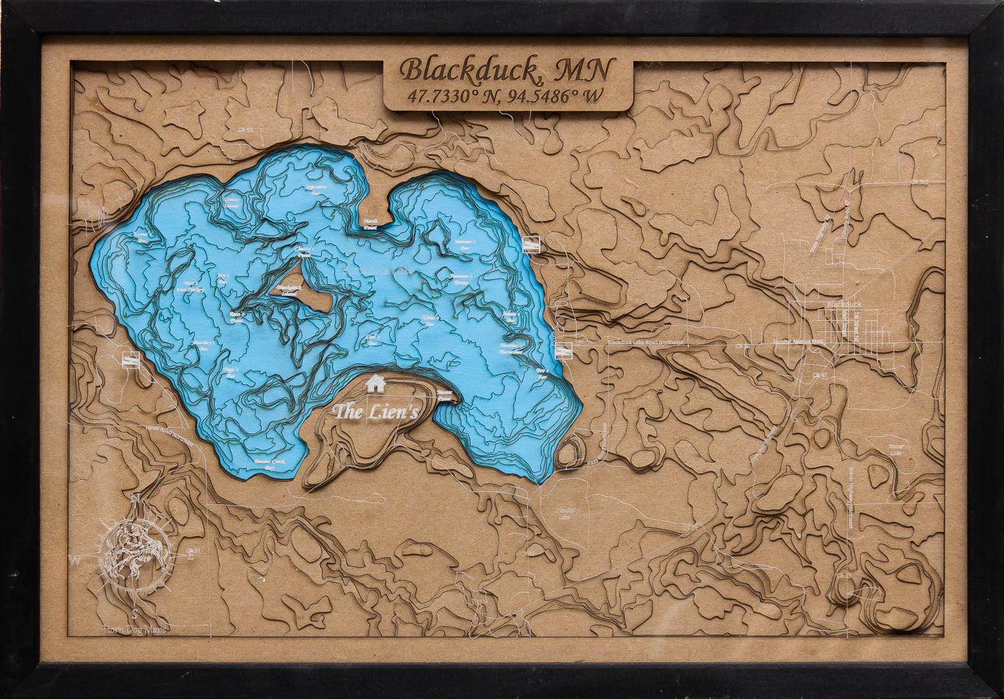
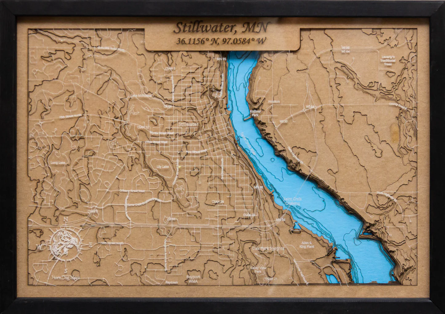
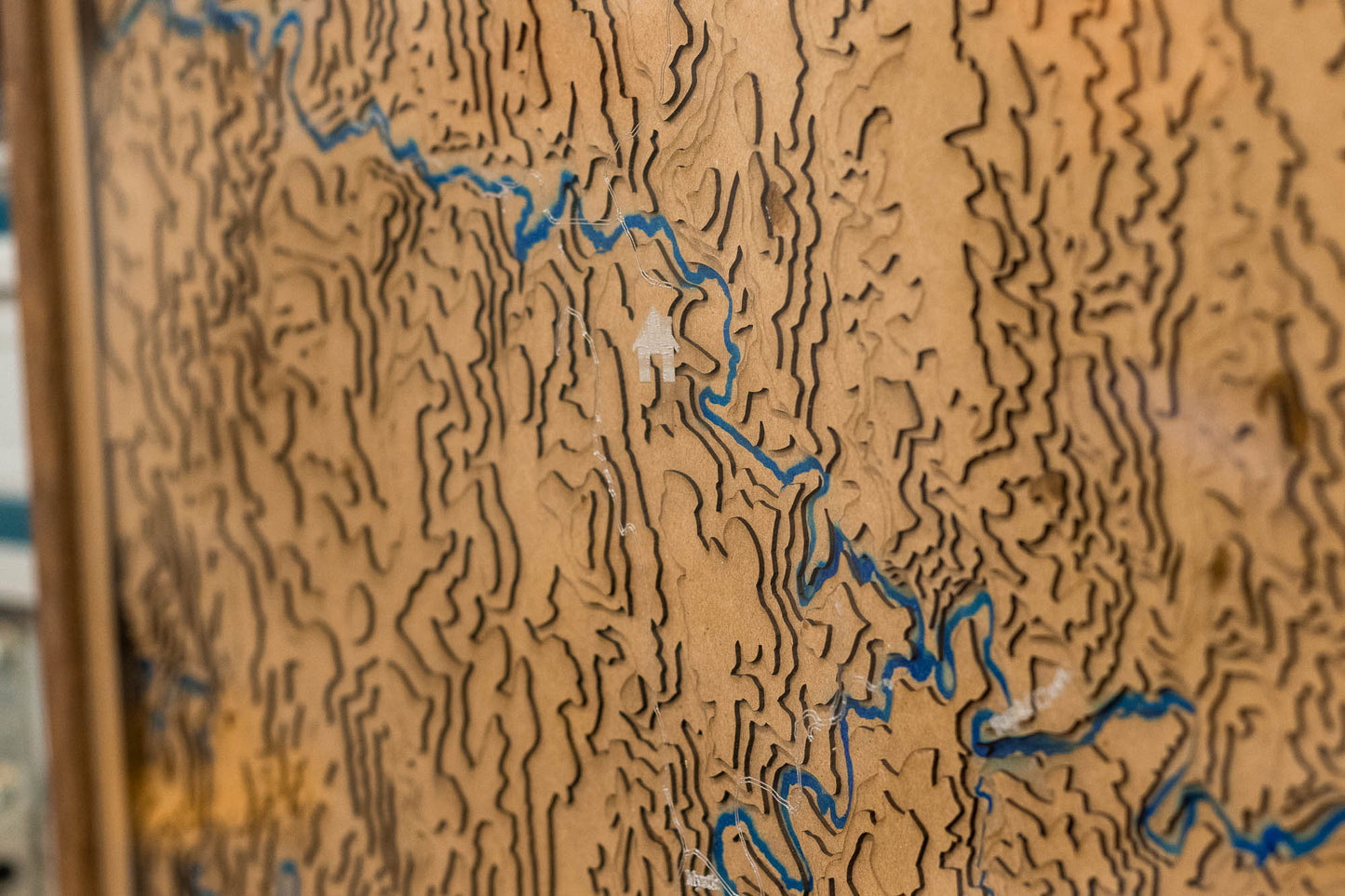
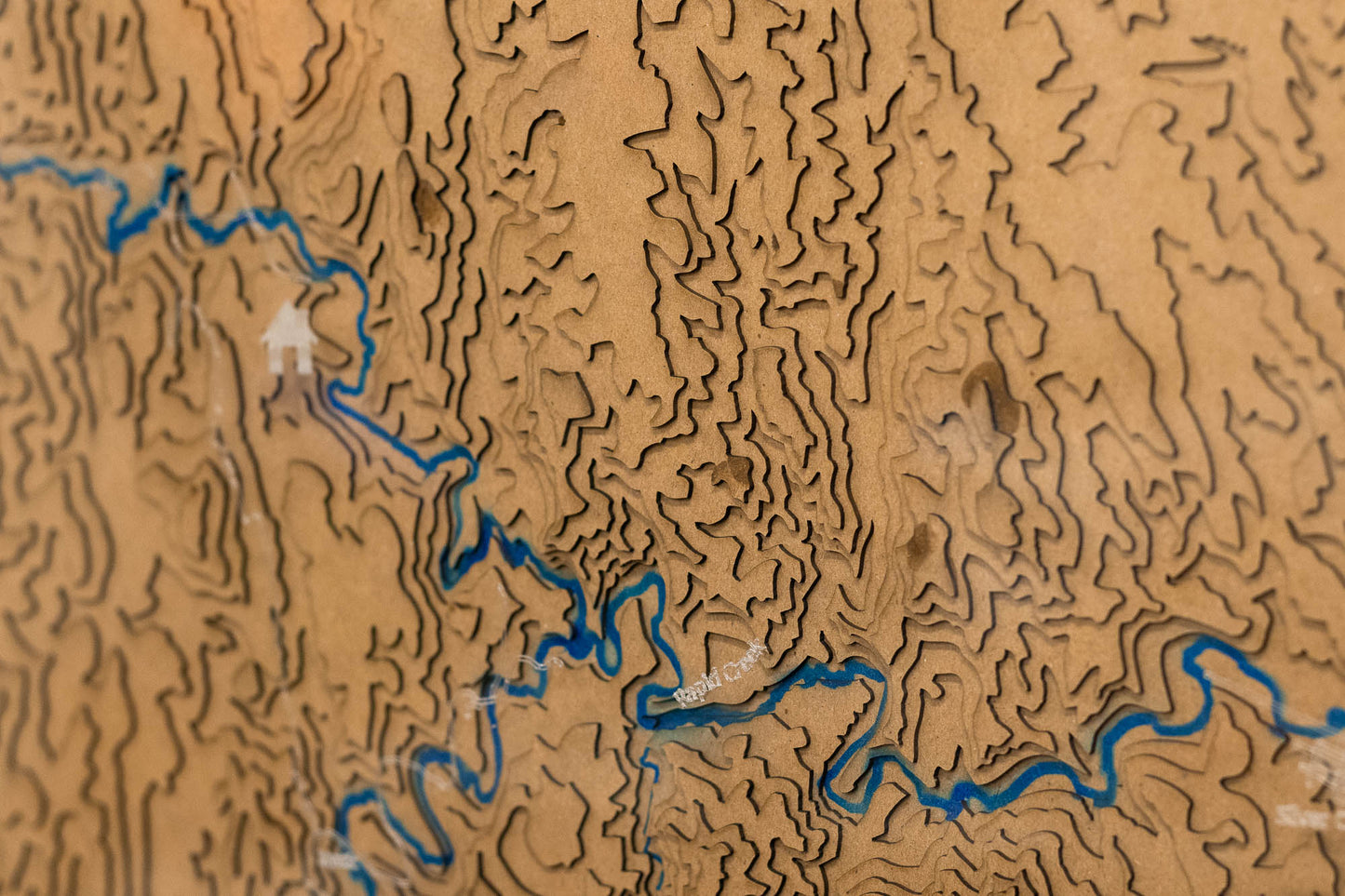
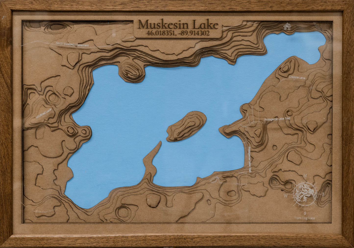
These topographic maps are made with multiple layers and then covered with a clear acrylic top layer. The roads, names, icons, and other information are engraved on the back side acrylic and are a frosty white while the surface remains smooth. The maps are then finished off with your choice of Black, Blue Stained Pine, Cherry, or Walnut. These maps are available in 3 sizes. 13"x19", 17.8"x26", and 26"x38". The total depth of the map including the frame is 1 5/8" deep.
Because of the nature of the chipboard used for the layers, it cannot be painted. Paint will cause warping which can affect the overall quality of the map.
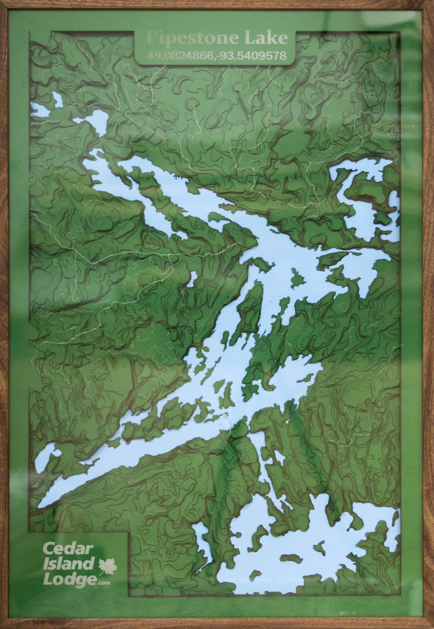
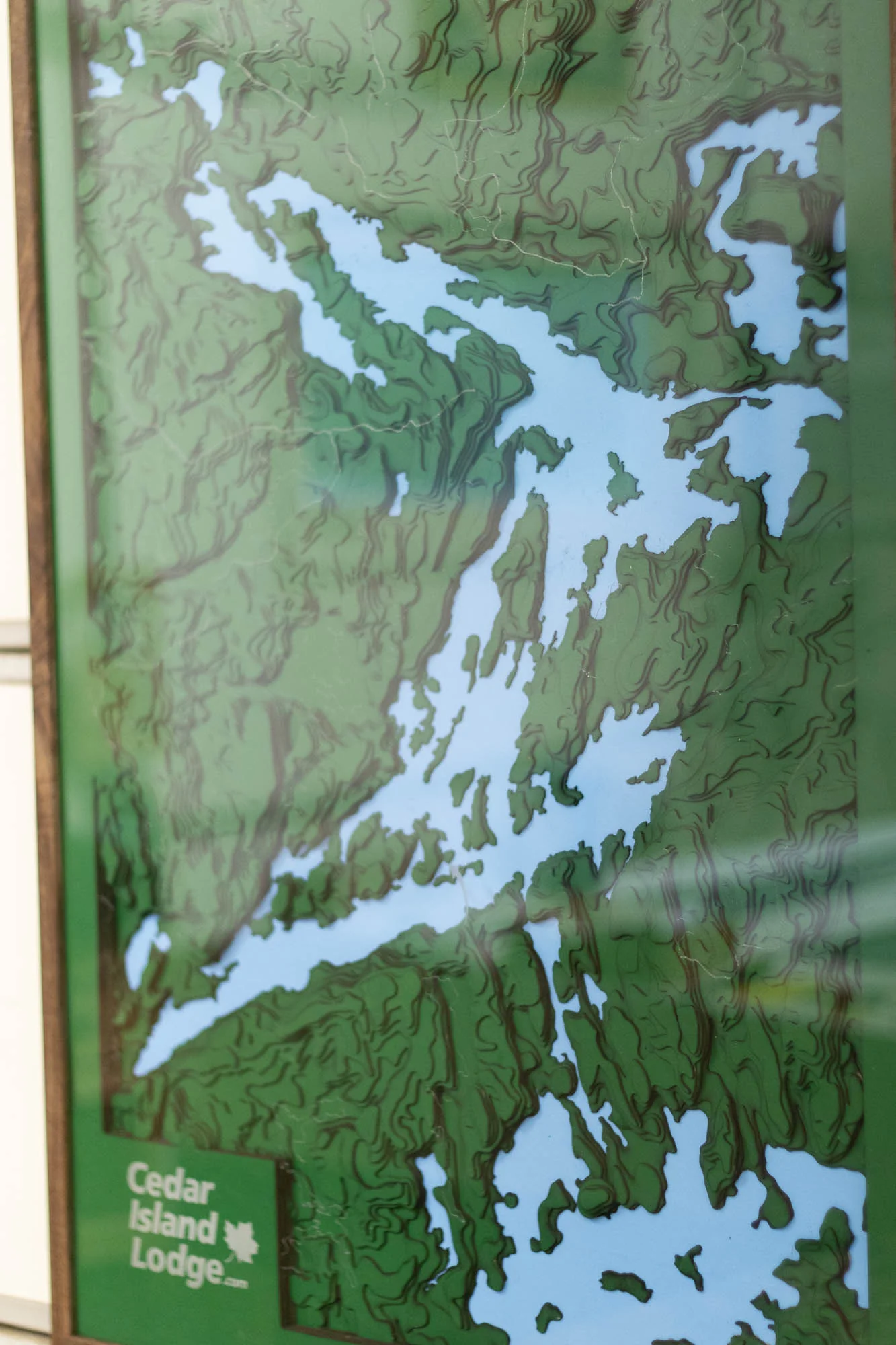
If a lake is the focal point of the map, the "water" will be blue and contours and other lake information can be added.
The maps will be finished off with a french cleat on the back side to help assist with easy hanging.
I ordered a custom map as a gift for family who live on a lake; the largest map size, of the lake they live on.
Mitch was very prompt in preparing a sample of the map, adding the customizations, and giving me good guidance on when I would need to order for the map to arrive for Christmas.
And then, when the map arrived, with the frame damaged in shipping, Mitch paid to have it shipped back to him for a new frame, no questions asked. Even when the map had to be refused the second time because UPS had somehow soaked the box in gasoline, Mitch took care of everything, quickly, cleanly, and without any fuss.
Now my family have a wonderful map for their wall.
We received our second stunning lake map crafted for us by Horn Dog Maps! Just like the first, this unique piece perfectly captures the lake's enchanting contours and tranquil allure. Mitch, the talented artisan behind these creations, has not only impressed us with his exceptional craftsmanship but also with his remarkable responsiveness throughout the process. His passion for his craft is evident in the intricate details that make each map a true work of art.
Whether you're an avid adventurer or simply love the serene beauty of nature, we highly recommend investing in one of Mitch's maps. Each creation serves as a stunning focal point for any wall, telling a story of exploration and the great outdoors. Trust me, you won’t just be getting a map – you'll be acquiring a timeless piece of art that embodies the spirit of the lakes you cherish. Thank you, Mitch, for your extraordinary work!
I saw a booth for Horn Dog Maps at a craft fair and was so pleasantly surprised that the lake my family goes to every summer was available and ordered! They even offered to create a map of the lake if I wasn't able to find it in their stock.
I opted for the plexi-glass covering since we have a dog that sheds and am glad I did.
Lots of frame and size options that will fit any budget and style. It arrived within a few weeks. I am so happy with the map we received!!
My husband’s 60th birthday presents is a map of our lake from Horn Dog Maps. He loves it! We’re impressed with accuracy of the lake and multiple layers add dimension. The map is a statement piece our family will treasure for years.
My sister and I purchased a beautiful map from Horn Dog Maps at a craft show in November 2024.
Mitch was amazing to work with and even added a detail of the exact location of our cabin on the map. Quick turn around times and beautiful quality map with accurate lake depths.
This was a gift for our parents for Christmas and they loved it!
Would highly recommend Mitch and Horn Dog Maps!
Mitch was great to work with and was very fast with responding to any questions I had. I had ordered a map in the past as a gift for my parents and then just recently ordered one for my in-laws. Both my parents and in-laws loved their maps. The map has a nice hanger on the back that allows for a flawless look on the wall. I definitely recommend working with Mitch and ordering your map.
I had a customer map done of Lake Pepin and Pool 4 of the Mississippi. It is beautiful and very sentimental as we have been boating on this part of the river for over 20 years. One of the best Christmas gifts I have ever given!
What a great company. Very very easy to work with. I order a map from him and in my excitement I didn't select the correct frame. I immediately emailed him and explained what happened and with zero issue he was able to fix my mistake. Absolutely a great company to work with.
We just received our map and LOVE it! I saw numerous sellers hawking these types of maps and oh boy did I pick the right seller!
The ordering was easy. It was delivered sooner than expected. The quality of the product is superb. The detail of the layers & roads are perfect. The contrast between the depth colors is very striking and appealing to the eye.
I went with the maple border with acrylic top 16x24 in size. Big and beautiful. I highly recommend adding the acrylic top.
It is a work of art that I can’t wait to give to my mom!
I agree with other reviews that these maps are a work of art. Our map of the Horseshoe Chain of Lakes came out beautifully - a very unique piece I am proud to hang in our lake house. The owner was responsive and very accommodating about customization. Worth the investment - you will love it forever!
We met Mitch in July at the Blueberry Festival in Ely, MN, where we admired the many maps he had on display. He took our order for our small lake’s map, noting to mail it to us only after we returned to the area a month later. In the interim, Mitch emailed us a mock-up of the map for review. We received the map in early September and were very happy with it. The workmanship is quite impressive. The map is now displayed in our cabin while we consider ordering a second one for our home.
Thanks, Mitch!!
Absolutely thrilled with my custom map! Mitch's dedication to ensuring every point of interest was included made all the difference. This piece has turned into a wonderful piece of art on my wall, capturing all my favorite spots beautifully. It's truly special and adds a personal touch to my home.
Horn Dog Maps exceeded my expectations with their attention to detail and craftsmanship. Couldn't be happier with the result—definitely a 5-star experience all the way.
Thank you so much, Mitch, and the entire team at Horn Dog Maps for creating something so unique and meaningful!
Absolutely stunning! Great work in detail and quality. We are avid fishermen and like to show off our replicas of our prize fish. I got a map to add to our display wall of where our big fish were caught. This map was just what we needed. 10 out of 10 recommend.
Cannot say enough about Mitch and his talent!! I had a request for a custom piece outside of his “normal” map making. He did an INCREDIBLE job & I absolutely love it!
I bought a map as a gift for my parents and they absolutely love it. It is beautiful and high quality work. Mitch was also super responsive and helpful.
Beautiful Map! I ordered a map of Balsam Lake Wisconsin. And it looks awesome! Horn Dog Maps, Mitch, did a fantastic job and accommodated me on a time sensitive gift. I'm very happy with it!
Given as a gift and the recipient loves it. He is going to display proudly in his living room. Would purchase again, as you make an excellent one of a kind gift!! Thanks, Chris
I contacted Horn dog Maps for My project, and Mitch did an excellent job. Mitch and I worked through several details which were not normal for regular maps. I found him to be very professional answered all my questions, he custom built my maps and mailed them out To me in reasonable time. The detail of his work is exquisite, almost like an artist. I would highly recommend Mitch at Horn dog maps for any of your Projects.
Very impressed with our purchase! We bought a gigantic map of Lake Superior in Cherry wood with the acrylic cover. This map looks like it belongs in a museum! The only thing that would make this map better is anti-glare acrylic. Nevertheless, it's an awesome piece to have in our home.
I had all my questions personally answered through email before placing my order. Very easy to work with and a great finished product. I am a happy customer.
This has got to be one of the coolest gifts I have ever received. The amount of detail in my map is beautiful! I would 100% recommend these maps. Very very beautiful work.
Super cool and detailed! LOVE it. Surprised my husband with Lake Superior map! He was in awe. That lake is just magical and to “see through it” with the layered 3D map is so interesting . Great quality framing and clear cover worth it to protect map . Ever consider marking the cities along the lake map? Would give another perspective to map .
Thank you for your unique skill and vision!
Well done !
We love our 3D lake map that Mitch put together for us. It looks awesome and he completed it quickly and the transaction was flawless.
We had ours customized with the location of our lake home and some additional verbiage. Love it!
AMAZED! During the busiest time of year, Mitch delivered spectacular work ahead of schedule. Not only was he ahead of schedule, he also promptly answered any messages within minutes. I am beyond impressed with the quality of work. Thank you!
I ordered a custom map for my brother in law for a wedding and it turned out amazing! I have a few cups that have been engraved from events by Horn Dog Maps and I love them! 10/10 will be using them again for other gifts.
Bought the map as a Christmas gift, and they LOVED it. Awesome detailed work and Mitch was great to work with. He responded to our messages and did a map of a lake not on his list!
Highly recommend!!
Keep up the fantastic work Mitch!
The map we got of Rainy Lake was a gift for my parents and it's absolutely stunning! Crisp, clean and an absolute show stopper. I am planning on ordering one for our own home. Really beautiful work!
My son had a map made of the lake our cabin is on for a Christmas present. I was absolutely blown away by the beauty and detail in the work. I would definitely recommend using this guy. Pictures do not do the maps justice. I can hardly wait to show this off to EVERYBODY!!!!!!! Amazing is all I can say. I hope he reads this. If I could call him I would. Thank you Horn Dog Maps. You rock.
If you’re wondering if these are worth the money, the answer is 1,000% yes. I’ve bought two different lakes so far and both were perfect. Worth every penny and I highly recommend.
Found him at the St. Paul Ice Show, He has almost any lake you can think of available for you to order from. Great quality, sends you a draft before he actually makes it for any corrections, and gets you what you ordered in a reasonable time. Would 100% Recommend and will definitely be ordering again in the future.
I won this map on the smackdown outdoors online sportsmans show in 2021. (sorry it took so long for me to send this review). I received the map very quickly and they were great about checking on what I really wanted even though I wasn't paying for it. When I received the map I was blown away at the detail. I didn't even know I wanted one of these until I received mine! I would definitely recommend Horn Dog Maps to anyone that has that special lake they love to go visit. The product and the service were exceptional.
I contacted Mitch with Horn Dog Maps after discovering his work on instagram. I immediately was impressed with his work and knew I had to add a map to my house. After some email communication back and forth (Mitch was always very prompt and answered all of my questions) I settled on a large map of Lake Michigan. Mitch was able to customize the map for a few requests I had and the order was placed. I was expecting a long wait and within days I received email confirmation the map was completed and being shipped. The NEXT DAY I received it and it was phenomenal. I am very impressed with the quality, the ability to customize the frame and background wood color and size. It looked even better in person and photos don't do them a lick of justice. Thanks Mitch for a fantastic piece of art and I'll definitely be ordering another!
UPDATE: It's been over a year since I purchased the first Lake Michigan map and it's still just like it showed up. No fading, delamination and so many positive compliments! I purchased a second map a few months ago (Lake Vermilion) in the extra large size with the acrylic top. Absolutely beautiful!! After receiving the map, I found out Mitch's Lazer omitted the compass rose and he too didn't catch the mistake. I contacted him and coordinated to ship the entire map back to him and he covered the shipping. Within a few days I had it back in hand. He bends over backwards to make things perfect and that means everything to a critical customer. Thanks again Mitch for everything!! These are the best!
Mitch is awesome! I purchased 4 large maps for our local business offices and conference center. We love them! After 6 months, we had a small issue with the layering of one of our maps. Mitch drove to our office, picked up the map, and delivered a new one in a week - no charge. Not only did he meet my expectations but exceeded them.
Exceeded expectations and very pleased. Craftsmanship and detail are outstanding. This will be a keepsake for our family cabin for many years. Great conversation piece for our family. Thanks Horn Dog Maps!
My wife and I ordered a map of Lake Bemidji last summer and it arrived in a couple weeks and was exactly what we were expecting. It's hanging on the wall in our office and has proven to be quite a conversation piece. I recommend highly!
I ordered a map of Platte and Sullivan Lake for my dad as he had just purchased a lake home on Platte. I was absolutely amazed with the finished product! The turn around time was faster than expected and Mitch was in contact with me throughout and always quick to respond! I would 100% recommend this company and their products!!
I ssw a Horn Dog Map one day while shopping in Hayward WI. I appriciated the quality and workmanship. The unique map, that was created for me, hangs in the family cabin. My father has passed but the map is part of my family heritage. My Horn Dog Map marks the waters my father fished and lake shore he developed. Thank you, With all my heart!
Found HornDog Maps through Instagram and MN Bound. Beautiful, quality craftsmanship. Mitch was so accommodating to my customization requests. We love our map so much! Highly recommend, makes great house/cabin warming or holiday gifts.
Mitch is a great example of small business perfection. Not only is he timely with his responses and production, he is more than willing to send prototypes, make adjustments for you own unique product, and ensure you are completely happy with what he is creating. I would absolutely recommend adding a Horn Dog Map to either your own arsenal of wall art, or on your list of potential meaningful gifts. Either way, Mitch will get the job done!
I couldn’t be happier with the level of quality I received in the product and service from Mitch. He was quick to reply and supply an example of what our Lake map would look like and worked with me in terms of adding a couple of extra features. The quality of the map surpassed my expectations and I was thrilled to be able to gift it to my husband on Father’s Day to celebrate our first cottage purchase. I live in Canada, which involved a duty fee, that I paid for through the company. When Customs charged me again upon delivery Mitch immediately refunded me the fee I paid him when I let him know. Our map is an amazing conversation piece in our cottage and we couldn’t be happier with it! Thanks Mitch!
Mitch at Horn Dog Maps was great to work with. He was super responsive, and quickly addressed all my requested customizations for my map. The lake was a new one for Horn Dog, but Mitch had it mocked up in no time. Shipped very quickly too, maybe 1 week from first emails back/forth to having the final product in my hands.
Bought a Bay of Quinte map for my husband’s birthday. Mitch was very responsive and accommodating.The map is self is very well-made and is the most detailed 3D depth map I’ve seen. I would 100% recommend buying from Horndog Maps.
The workmanship was tremendous. Mitch took the time to customize my project. Only complaint was that one of the two maps were damaged in shipping. Mitch properly made it right by me. 1st class all the way
I contacted Horn Dog Maps for a custom order. He had a proof uploaded to his site for purchase the next business day. The item was perfectly done. I ordered a depth map of a lake that my in-laws live on, and every aspect of the map was as-is in reality—from the depth, to the shoreline and the positions and names of surrounding roads. These maps will make great decorative pieces in a home, and they'll make for excellent gifts for friends and family who have a special connection to a particular body of water.
Amazing craftsmanship and quality. I highly recommend ordering from Horn Dog Maps. He was able to draft up a custom lake map for me and it turned out amazing.
Beautiful work. Quick turnaround. It was a gift for a friend and he loves it and is hanging proudly in the family room overlooking Rush Lake in Ottertail County. Highly recommend and will use him again.
I ordered a framed map as a Christmas gift for someone really special to me. The pictures don’t do the product justice! It is truly amazing and beautiful work. Support this business, it’s QUALITY!
Mitch did a fantastic job with the map of a lake near my family’s cabin. I gifted to my dad for Father’s Day - he and the rest of the family were so impressed! So fun to see the different landmarks on a lake he and my grandfather have been fishing for years. Mitch communicated quickly and effectively regarding timeline updates, questions, etc.
I’ll be buying from Mitch again if the rest of my family doesn’t beat me to it!
I ordered a map of the Spread Eagle Lakes for my boyfriend’s Dad! It was his favorite Christmas present! It has been such a cool way to bring his favorite lake into his California home across the country!
Working with Mitch was an amazing experience! He was very responsive and able to edit and customize my map exactly the way I wanted. The lake map I was looking for is a small lake off the beaten path and he was able to do it! The lake map was given to my father for xmas and it brought tears to his eyes. Highly recommend horndogmaps for anyone looking for that special gift for someone or an addition to a cabin.
Ordered an XXL map of our lake for an empty wall. The piece came very quickly and it is a true work of art! We get tons of compliments and it is so great to have a visual representation of the lake for reference. Would highly recommend if you are looking at one of these for your home or cabin!
Thank you for the wonderful lake map! Mitch worked with me to make the changes that I requested and the map turned out great. The turn around time was fast and arrived with plenty of time as this was a gift for Christmas. Thanks again and I have already recommended Horn Dog Maps to others.
Saw the booth at the ice fishing show. Amazing maps amazing detail and quality of work! The final product was delivered early with no damage! Go and buy one especially if you live on the lake!
I ordered a 3d Map from HornDog back in October as a gift for my mother and her husband for Xmas. It arrived within a few weeks of placing the order, which for custom work, is quite impressive. Communication with Mitch was prompt and he answered all the questions I had. Upon receiving the gift at Christmas, my mother's husband was exploring the map for the rest of the evening, explaining where they fish, where they have and haven't been and areas that look like spots they'd like to explore. I would STRONGLY recommend doing business here if you are looking for something unique for the fisher, camper or lakes fanatic in your life! Beautiful product!!!!!!
The map I received from Mitch at Horn Dog Maps was awesome!! My husband loved this gift he received for Christmas of the 3d Laser Cut depth relief map of Lake we live on! Plus Mitch put in a special touch of showing where our house was located on the lake which made it even more cool and very special!
Thanks for making our map the quality and detail you put into it was wonderful!!
Phenomenal service, and quality work. I seen his products at the Minnesota State fair, and was blown away. I gave 2 of his maps as Christmas gifts. One for Lake Osakis, and the other for Cedar Lake in Annandale. Both look amazing. No lake home is complete until they have a horndog map.
Horn Dog Maps was fantastic. Found the lake we needed and Mitch went out of his way to ensure the accuracy of my request. The end product was super fantastic. Would recommend this product to all.
My siblings and I are gifting a map to our parents and I am excited for them to see it! Excellent work, fast shipping, and Mitch worked with me to make a customization. Thrilled with how it turned out!
We received a beautiful donation from Horn Dog Maps and we couldn’t have been happier! One day when I own a home I will definitely be purchasing one of these hand made maps. They are high quality and such a fun touch to anyones home, office or cabin!
Just received my first order. It is beautiful! Such detail and high quality. This was a gift and I think I’ll order another for myself! Very happy with this purchase!
I ordered a map of a lake my husband and his dad fished as a gift for my husband for his birthday, and it was perfect! His dad passed away in 2020, and this gift meant so much! Thanks again!
I reached out and requested a lake that hadn’t already been done yet. The response time was very quick. The map was beautifully made and arrived much quicker than I expected. I was very impressed with how detailed and accurate this map was. Purchased the item for my grandpa and it was such a hit I will be purchasing another for my dad.
I have ordered several lake maps from Mitch. The maps have made great gifts. He has always been super easy to work with, prices are good, and always delivered them on time. Thanks Mitch!
Mitch did a great job on a lake map for my parents for Christmas. Very responsive to questions. Easy to work with and great quality. Highly recommended!
I ordered a custom made map of Lake Bemidji for my husband. We both loved it. The map quality is great and it was packaged and shipped well too! I would defiantly buy another product from Horn Dog Maps!
Horn Dog Maps do an amazing job of creating 3D maps. Our daughter worked with Horn Dog to focus on a smaller area of Lake of the Woods for a 2020 Christmas gift to my husband. My husband was thrilled when he opened his Christmas gift of Shoal Lake Narrows, which Horn Dog Maps wonderfully accomplished. My husband has been going to Shoal Lake Narrows for all of his life, this was the first 3D wood map of his beloved Canadian summer refuge. My husband and I are now ordering from Horn Dog Maps more 3D wood maps. I give them 5 STARS for their finished product, their ability to work with each customer to focus on the lake/area of request, for their dependability and promptness. Please use Horn Dog Maps, you will be pleased!!
I got my first map from Horn Dog Maps in 2020 and I was *blown away* by the quality. Mitch was great to work with and happy to help me make some decisions regarding my custom map to make sure it turned out perfectly. I gave the map as a gift to a family that let me stay at (and fish at!) their family cabin for many years, and it was a very special moment. I plan to order one for myself in the near future, and I would definitely send one as a gift again too. Beautiful, high quality, meaningful and great customer service. I highly recommend!
I purchased the Cass Lake Chain Map for my wife's birthday, it was absolutely great and would defiantly recommend purchasing from Mitch. the custom map came very quickly and was packaged excellent. We love the map and it is now hanging in our living room.
I have purchased two custom jobs as gifts from HornDog and they are so beautiful. He is great to work with, items arrived quickly and communication was excellent. We are going to also order a Lake Superior map soon from him for our own home. I highly recommend his work for any known or even unknown (if you provide the GPS location) lakes.
I ordered one of these maps of a chain of lakes we have been fishing for 13 years. All I can say, is it is absolutely perfect! Mitch has the best customer service, and it was completed and at my door in no time at all! The map is solid, clean cut, and beautiful! For those who love being on the water, I couldn’t think of a better gift! I was also lucky enough to win a second map at a fishing event, and I cannot tell you how happy I am! I 100/10 recommend purchasing from this business.
Great product, brought it for my mother and was prompt with sending it to her. Also didn’t have our lake on file but was able to make a file for it super fast!
When I saw a friend post about their lake map from Horn Dog, I knew I needed to get one. At the time, our lake wasn't one of the choices, but Mitch had ridiculously quick correspondence letting me know he could make our lake. When it arrived, I described it as "Perfect" and my family said it was arguably "Too nice." 5/5 stars and 10/10 recommend
I Loved the Turtle River Lake map! It’s beautiful and well made. Communication was an ease and the map was mailed quickly and packaged carefully! Thank you and I will be buying more in the future!- Sarah, Bemidji MN
I had bought a map for a Christmas gift for my parents. They had just bought a lake house and the lake they were on was not an option on the site. I emailed Horn Dog Maps and Mitch had the lake up on his website in minutes. Excellent customer service and I'll refer him to anyone I know and would recommend his business to anyone! Thanks again Mitch! Awesome product and excellent craftsmanship!
I have ordered 5 maps from HornDog Maps (1 for me and 4 gifts) and all are AMAZING! Great customer service, quick turnaround, and jaw dropping quality! Highly recommended by me!
We purchased our first lake home and had a map of the lake done by Horn Dog Maps. It turned out beautifully and I get lots of compliments on it when friends come over. I highly recommend connecting with Mitch if you are looking for your own lake map!
Mitch does amazing work! He had his laser machine go down just before Christmas after I had placed and purchased one of his stunning maps. He was diligent in making me aware and refunding my full payment. Lucky for me he got up and running and I was able to get it in time for Christmas. My hubby loved it, actually brought tears to his eyes. His favorite lake and he's put lots of blood sweat and tears into.
I live in Canada to, a little gaunt away and he packed it well no damage during travel which I was a little worried about. But hands down would recommend doing business with Mitch at Horn Dogs Maps!!
Mitch made me a gorgeous map of Lake Lida. He went above and beyond and I was blown away the quality. Highly recommend for your home, cabin or a gift if you or someone you know loves water like I do!
We bought a customized piece from Mitch for a family member this past Christmas. Having never met Mitch and buying a piece through the “cyber world,” I will admit to having been a bit nervous, as you don’t know what you will be getting. Well...not only were we extremely pleased with the customer service but we also received a work of art. He immortalized a very special place with his work, and I can not speak highly enough about the quality of the product as well as for Mitch. If you are looking for a wooden masterpiece, look no further than Horndog Maps!
Great woodwork job, very pleased with the final product. I have recommended Horn Dog Maps to friends and family already, as their work was of amazing quality and they were very accommodating with my requests.
Quality product that exceeded my expectations. The customer service was even better. Couldn’t be happier as a customer. I will be placing future orders for sure.
I ordered a custom map for my husband for Christmas, and it turned out beautiful! It is a nice focal piece in our living room, and we always get compliments on it. Great attention to detail, and solid quality!
I ordered a map for my parents for Christmas. The lake I want wasn’t on the list and when I inquired about it, he had my draft of it to me within HOURS! I loved the look so I ordered it. I was so excited, and then I saw he was running a sale a day or two after I ordered. It’s COVID and was Christmas time, and money is not aplenty so I reached out on a limb about the discount. With no thought otherwise, he refunded me the amount that I would’ve saved with the discount! Best service from a small business I’ve experienced.
The most beautiful pieces of art I have ever owned! The owner is so kind and giving, and his work is incredible. The perfect gift, or way to treat yourself. He made a lake of a map that is very special to me and was more than willing to listen to the specifics and personalizations that I desired. Everyone I know who has one absolutely loves it. The craftsmanship is amazing. Many different options so you can get a style you like, and many different lake map options as well. Highly recommend!
I gave a northern Minnesota lake map wall art as a gift to a dear friend. Mitch did not disappoint. It was such a unique and interesting gift and she hung it up immediately. In fact, she commented about being able to find the spot on the map where a cell phone was dropped in while fishing.
The quality is high, the colors are just what we asked for, and the custom fish icon design was perfect. These well-crafted maps are a perfect gift item for those connected to any lake. It's a great way to bring back memories and strike up conversations. Very well crafted.
Amazing craftsman ship completed in a timely manner! The owner is a really nice guy and was able to accommodate all of my requests! Would recommend and will definitely be doing more business with them in the future!
Well if you're not in the market for a mannequin, a garden hose or house staging (read other reviews) and are instead looking for a beautiful custom 3D laser cut map of a lake that's special to you, then you're in the right place! I love my map, but beyond that, Mitch stands by his work and went out of his way on the customer service side of his business. My map got slightly damaged during the shipping process and his response to the issue was kind, fast and professional. Highly recommend!
My husband found this guy’s page on social media and I’ve been following him for a while now! He’s really passionate about his products and you can tell that each one is a work of art! I can’t wait until my husband decides which lake he wants on the wall so we can order ours!! A few of my favorites from his social media attached!
He made me the COOLEST custom map of Big Portage Lake. Mitch is a good dude who does amazing work at a great price. Absolutely blown away by the intricacy and quality. Will 100% order another. WOW!
I ordered a custom map of the lake around Disney World's World Showcase as a 5-year wedding anniversary gift for my husband. We got married on that lake so it was perfect since the traditional wedding gift for year five is wood. My map turned out just like I wanted! It's beautiful and came with a hook on the back so it was ready to hang up on the wall. I would totally recommend anyone get this as a special gift for anyone!!
See More
Subscribe to our emails
Be the first to know about new collections and exclusive offers.
Choosing a selection results in a full page refresh.